

4 season destination


The cultural landscape of Zagori was declared a UNESCO World Heritage Site in 2023.
The Vikos-Aoos National Park is an area of protected natural wealth, north of the city of Ioannina, in Zagori, Epirus. It was officially declared a national park in 1973 and borders the Pindos-Vallia Kalda National Park to the northeast. The area has been included in the European network of natura 2000 protected areas and stands out for the intense changes in the natural landscape: densely vegetated areas alternate with steep cliffs.
The Vikos-Aoos area, which is one of the ten national parks of Greece, includes the Vikos gorge which is the core of the park as well as part of the Tymfi mountain range, the Aoos ravine as well as a series of traditionally preserved settlements. It has also been called the "Forest of the great peaks", due to the steep and high peaks of the area, with the highest being Gamila (2,497m.) in Tymfi. It has an area of 122,250 acres, of which 34,120 are its main core. The area contains an extremely rare and sensitive ecosystem, which is why no human activity is allowed, except those related to browsing and recreation during the day.
Vikos Gorge
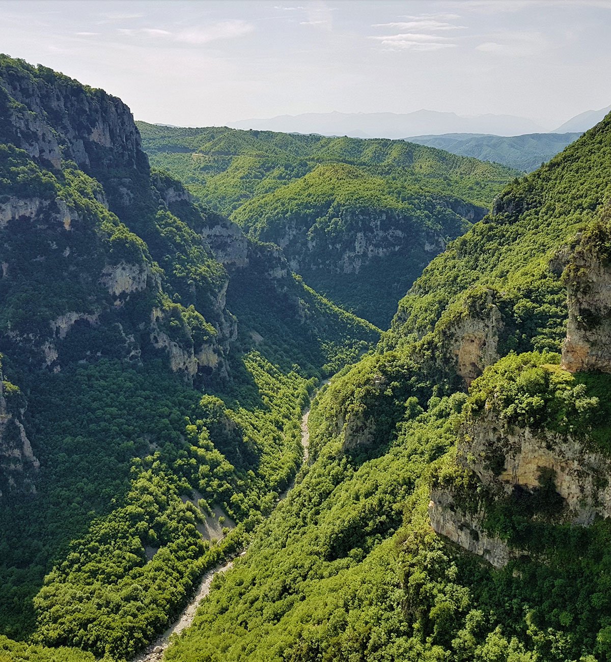
To the west of the forest is the ravine of Vikos that crosses western and central Zagori, starting north of the village of Vikos and ending southeast at the villages of Koukouli and Kipoi. Traces of human activity have been identified since 40,000 BC. The canyon is water-borne and stretches for 12 kilometers and is recorded in the Guinness Book of World Records as the world's smallest canyon. Its width varies from 100 to 1,000 meters. The tributary of Aoos, Voidomatis, which runs through the gorge has water only seasonally.
The canyons were created by intense geological rearrangements. The flora found in the area of the gorge is particularly diverse. Until the beginning of the 20th century, the herbs of the gorge were used by practical doctors, the so-called "Vicogyatros" for therapeutic purposes. The view from some points along the gorge is breathtaking. Especially from the village of Vradeto (place Beloi), as well as from the place Oxia. In Monodendri is also the "stone forest", a set of huge rocks that stand up like steep trees, with successive layers of stone, a remarkable geological phenomenon. Particularly picturesque is the Monastery of Agia Paraskevi, located right on the edge of the cliff, built in 1413.
The Vikos Gorge is one of the most popular tourist routes, the duration of the tour for an experienced group does not last more than 5 hours, offering unique images. In the area of the gorge, any human activity related to animal husbandry and of course logging is strictly prohibited.
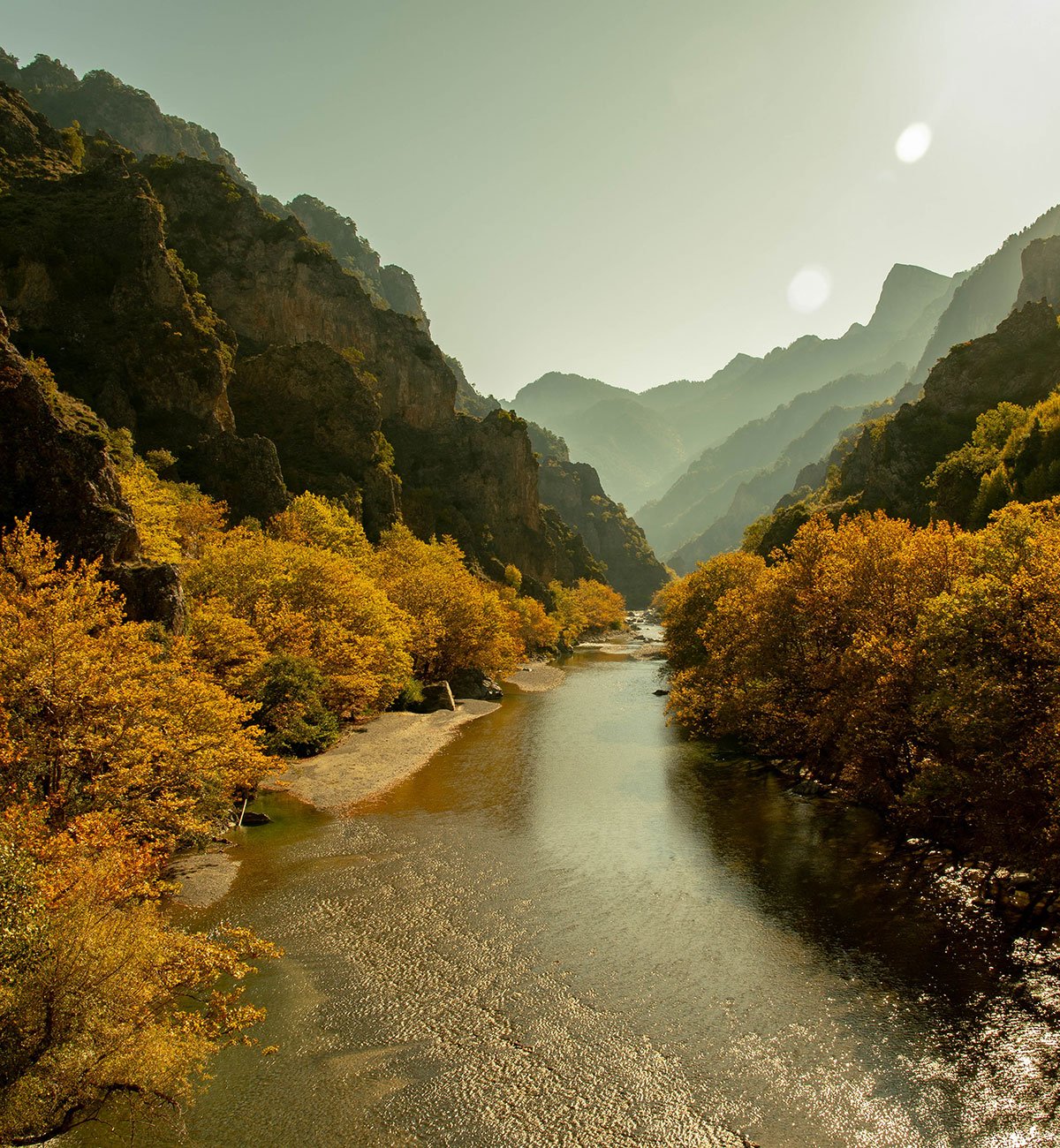
Gorge Aoos
The Aoos river in the northern part of the forest, crosses particularly dense vegetation. The river runs through the slopes of Tymfi, Trapezitsa and Radovouni. The length of the ravine is a total of 8 kilometers and its width ranges from 300 meters to 2.5 kilometers.
It is generally one of the popular destinations for canoeing and rafting (it offers different levels of difficulty depending on the section of the river). At the height of the Gravos waterfall is the historic Stomio Monastery, built in 1774. Characteristic is the large single-arch bridge of Aoos (1780), which also marks the northern border of the Forest.
Tumfi
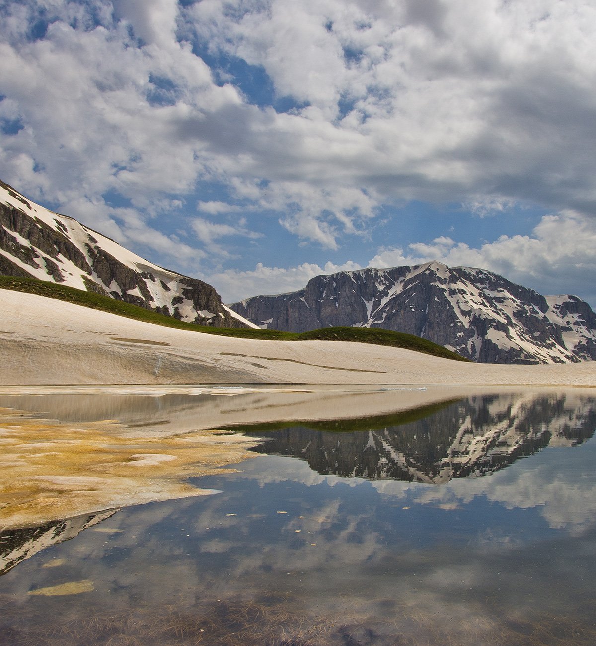
Drakolimni, in the background the peak of Gamila. On the western slopes of Tymfi (also called 'Gamila' by the locals) are the traditional settlements of Mikro and Megalo Papigo. Directly above Mikro Papigo dominate the "Astraka Towers", huge imposing rocks.
There are many lakes of various sizes in the area. The "mythical" Drakolimni is the largest lake of the national park, at an altitude of 2,050 meters. It is an alpine lake which owes its existence to the glaciers that existed in the area 10,000 years ago. It is named after a local legend. The depth was said to reach 200 meters and it is assumed that it communicates with the underground water network of Tymfi. But the truth is that the depth of the lake does not exceed five (5) meters. To the right and left of Drakolimni are the Astrakas (2,436 m.) and Gamila (2,497 m.) peaks.
The fauna of the area is also noteworthy: in this environment also lives the alpine Triton, a rare species of amphibian (in the form of a colorful iguana), which is not found anywhere else in Greece. The Tymfi mountain refuge is located at an altitude of 1950 meters, below and north of the peak of Astraka. It is the meeting point of several hiking trails.
Activities
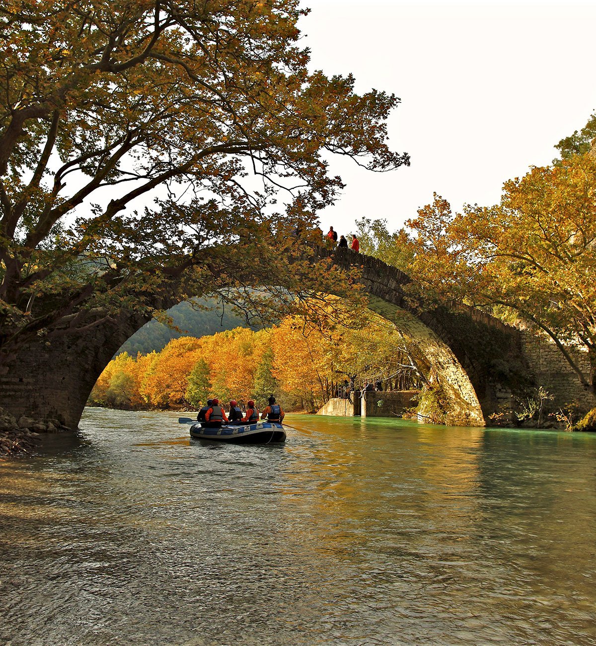
The area is suitable for hiking and mountaineering, the tours give the opportunity for unique contact with the pristine natural environment. The sports activities related to nature and which are particularly developed in the area of the forest are mainly: kayaking, rafting, long-hour ascent to the peaks of the area and horseback riding. Countless are the number of routes that vary from a simple walk to a long climb to the peaks of Gamila.
The most frequented hiking routes are located at the following points: Gamila, Drakolimni, Viko, Koziako, Kousta, Tsouka Rosa, Avgo and on the marked paths with the code Z, which connect the settlements of Zagori. There is also the possibility of paragliding in Asprangelos, horse riding, canoeing in the Vikos gorge, kayaking and rafting in Voidomatis, Aoos, Vardas and Zagoritiko. Also the caves and precipices on the Tymfi plateaus are suitable for exploration. The area hosts a mountain refuge in Astraka.


